| Delaware Water Gap - Appalachian Trail |
|
|
Links to the Gap Area |
| Delaware Water Gap - Appalachian Trail |
|
|
Links to the Gap Area |
|
|
|||
|
See all our Appalachian Trail / Delaware Water Gap Pictures - Click Here |
|||
July 2011 - New Video!
|
Tiger-USA.com's favorite hiking
space is the Delaware Water Gap in Northeastern Pennsylvania. Just take Exit
310 off Interstate 80 toward Route 611 South (Road
Map), and you'll wind up near this small part of the Appalachian
Trail. The flexibility of this trail gives you many options to choose from . You can take
as little as a short 30 minute walk to a 6 hour daytime workout hike or even an extreme
weekend overnight camp out at the top of Mt. Minsi. Note: the town of Delaware Water Gap, PA itself is a historic meld of gift shops, homes and antique stores worthy of a leisurely stroll, if you wish to extend your time in the area. |
|
|
|
|
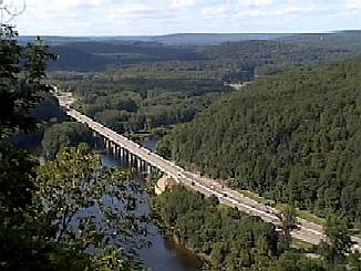
The first lookout
spot, called Council Rock, is accessible to almost anyone. It is a relatively easy 30
minute round trip from the Route 611 scenic overlook parking lot. From this spot you can
view the Interstate 80 bridge as it crosses the Delaware River.
|
|
|
Eureka Creek is a refreshingly cool clear water creek, which flows down from Lake Latini. Although Tiger-USA.com has no knowledge of the quality of this water, but it is extremely clear.
|
||
|
|
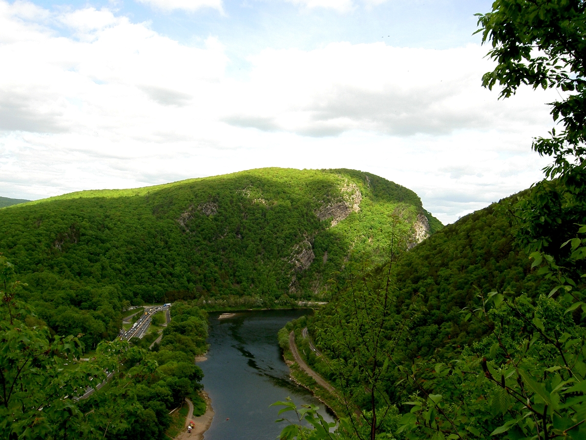
This
vantage point affords an excellent view of the Delaware Water Gap and River. From this
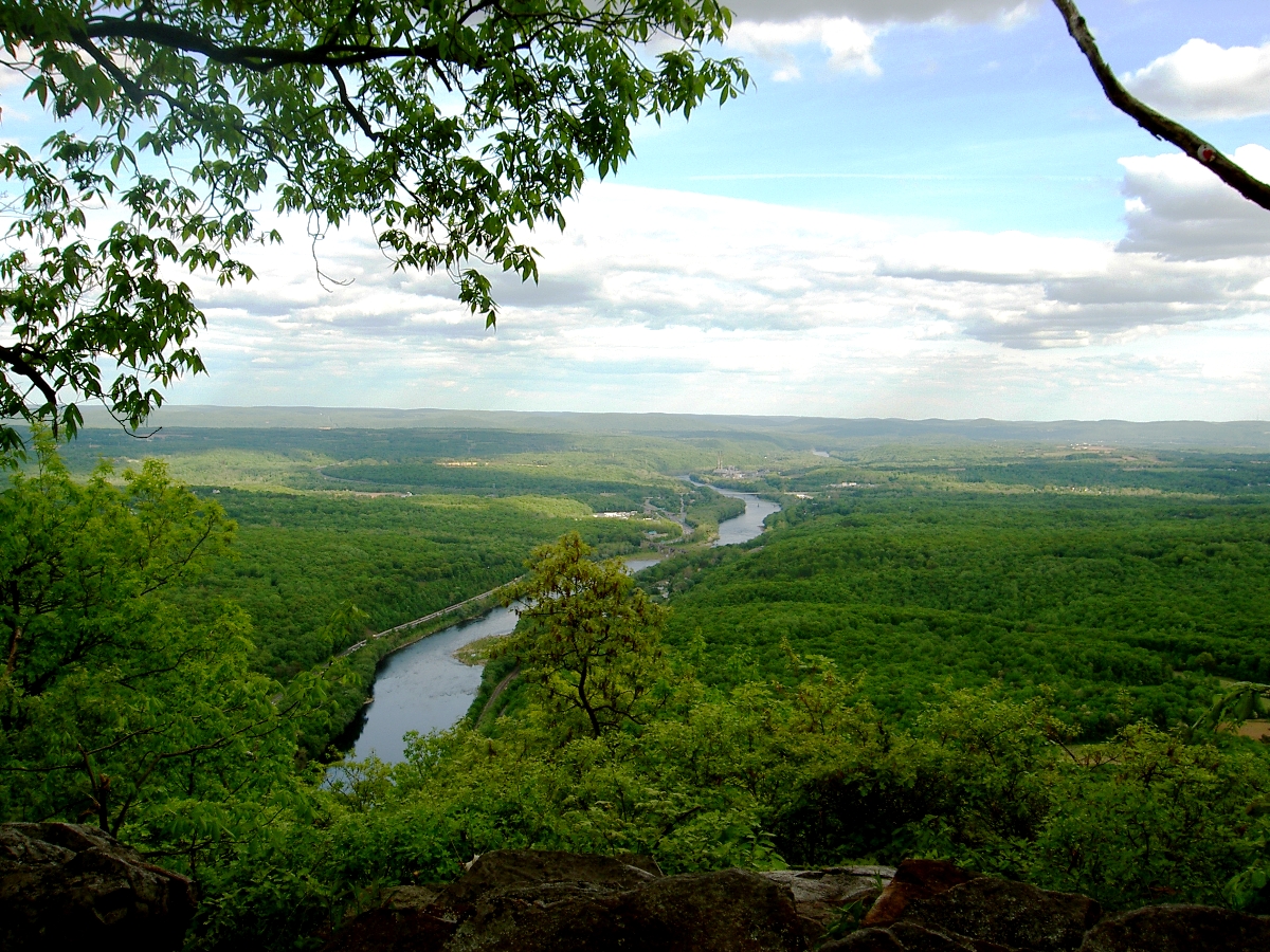
point the "novice" can make their way back to the car and call it an afternoon. NOTE: From this point on the trail becomes noticeably steeper, rockier and strenuous. If you decide to traverse these trails be careful! So far, you have traveled about 300 feet in altitude up the trail. The trip to the next lookout on the trail requires hiking at about 20-30 degrees and covers about 600 feet of additional altitude. The views from this level are dramatic and worth the workout. While on the way be sure to view the surroundings of this area. |
|
|
|
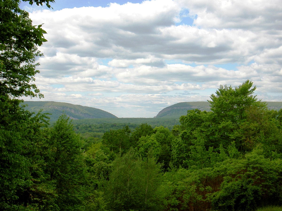
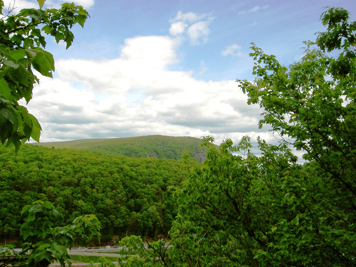
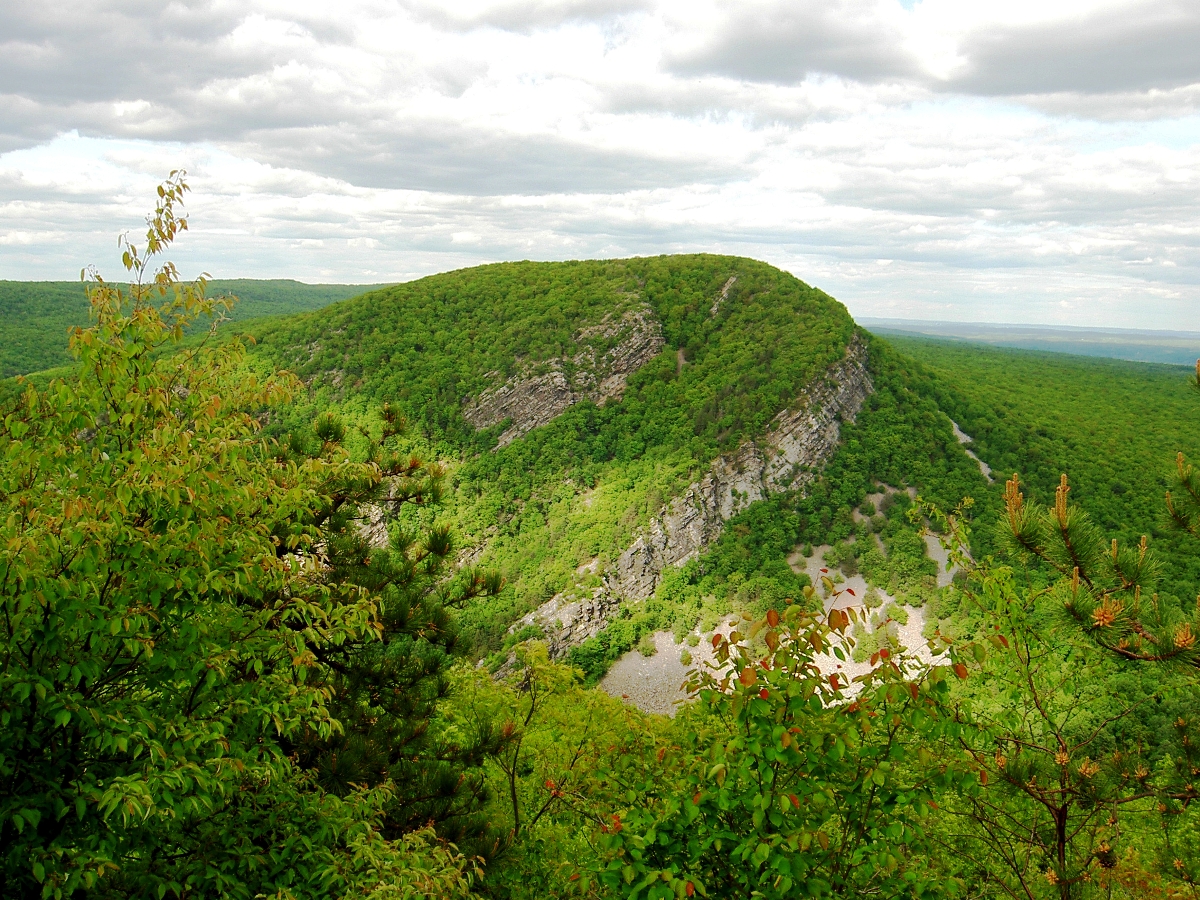
At this point, you have hiked vertically the equivalent to the top floor of the Chrysler Building in New York city (77 floors) To the left is a view looking out toward the Northwest from Mt. Minsi. Interstate 80 crosses the bridge from NJ into PA in the foreground. In the background, the "rolling hills" of the Pocono Mountains. Except for the highway, it seems the trees are endless. Also to the left from the same travel point, but looking to the NNE, is this view to Mt. Minsi's sister mountain (Mt. Tammany) on the NJ side of the Delaware water Gap. ***********
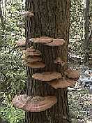
Below, a very interesting tree we just could not resist capturing here. We call it
the Mushroom Tree. |
||
|
|||
|
|
|
|
|
|||